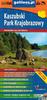
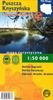
The map is double-sided and shows the western part of the Polish Carpathians, including the entire Silesian Beskids, the Little Beskids, virtually the entire Makowski Beskids, the Żywiec Beskids with Babia Góra, parts of Podhale, and the Western Tatras. Half of the map shows our neighboring countries, including a small section of the Czech Republic south of Cieszyn, the entire Orava Beskids, a significant portion of the Kysuce Beskids, most of the Little Fatra, the entire Choč Mountains, all of Orava, and almost all of Liptov. It is a road, cycling, and ski map. The legend contains approximately 90 symbols, described in five languages (PL, GB, D, SK, RUS). The highly visual, colorful shading clearly illustrates the terrain. The map's distinctive features include a dense road network, clear accommodations and hiking trails, cycling trails and routes, clear ski lifts, walking times on major trails, a GPS grid, and detailed development. Attractive towns and attractions, such as water parks and castles, are highlighted. Roads have clear mileage, and highways and bypasses under construction are shown, both in Poland and Slovakia. Bus stops and train stations are also shown, along with the boundaries of national parks, landscape parks, and reserves. However, the borders of the three countries are barely visible on the map – this is intentional, as borders are no longer significant. The information sheet on the reverse of the map includes, in addition to the northern part of the discussed area, maps of six towns: Cieszyn, the center of Bielsko-Biała, Żywiec, Žilina, Ružomberok, and Liptovský Mikuláš. It also includes a tourist guide and extensive information on towns, mountain ranges, rivers, and protected areas. The map is updated annually. It is particularly recommended for motorists and lovers of beautiful landscapes and historical monuments. Ideal for those interested in the Polish-Slovak border region.


 Remboursement en cas de non-livraison